All news

Upgrade and redesign of company website
2020-08-25
In order to meet the needs of development, establish a new brand image, and better meet customer visiting needs, Beijing Aerospace Jiatu Technology Co., Ltd. has upgraded and revised the original website. After months of careful planning and preparation, the new website www.yhmap.cn was officially launched on September 9, 2020, and will serve users nationwide with a brand new attitude.

The Institute of Remote Sensing and Digital Earth of the Chinese Academy of Sciences signed a cooperation agreement
2020-07-16
On July 16, 2020, our company signed a strategic cooperation agreement with the Academy of Aeronautics and Astronautics (formerly the Institute of Remote Sensing and Digital Earth of the Chinese Academy of Sciences, and the Landsat Earth Observation Center) to provide services for satellite image data acquisition and processing abroad. Fully leverage the company's advantages in data acquisition, data production, and data processing software to provide professional, high-quality, and efficient data services for Aerospace Research Institute.

Rising space technology: Small satellites are gaining popularity
2019-01-18
Focusing on cutting-edge technological innovation and upgrading traditional industries, "Ultimately, satellite constellations may resemble more of a neural network or artificial intelligence system, enabling self-organization, deformability, self-learning, and large-scale shared perception."
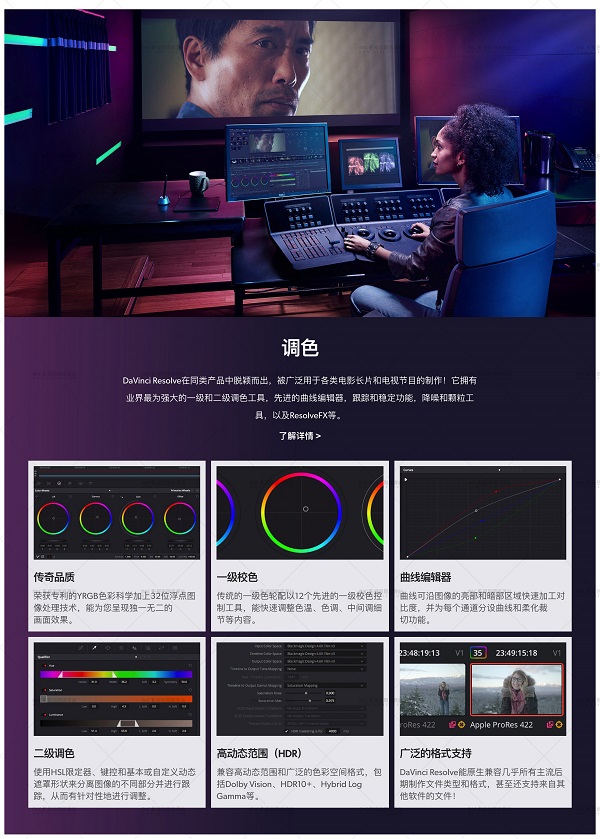
Introduction to AutoMap Automatic Fusion Color Adjusting Software
2018-11-15
Satellite image fully automatic fusion software provides batch automated data fusion processing for multi-source land remote sensing satellites. This software uses the Photoshop plugin technology, based on the Photoshop platform and a self-developed remote sensing image computing knowledge base, to automatically color adjust and enhance multispectral and panchromatic images in remote sensing images, achieve geographic coordinate matching, and output commonly used remote sensing image formats.
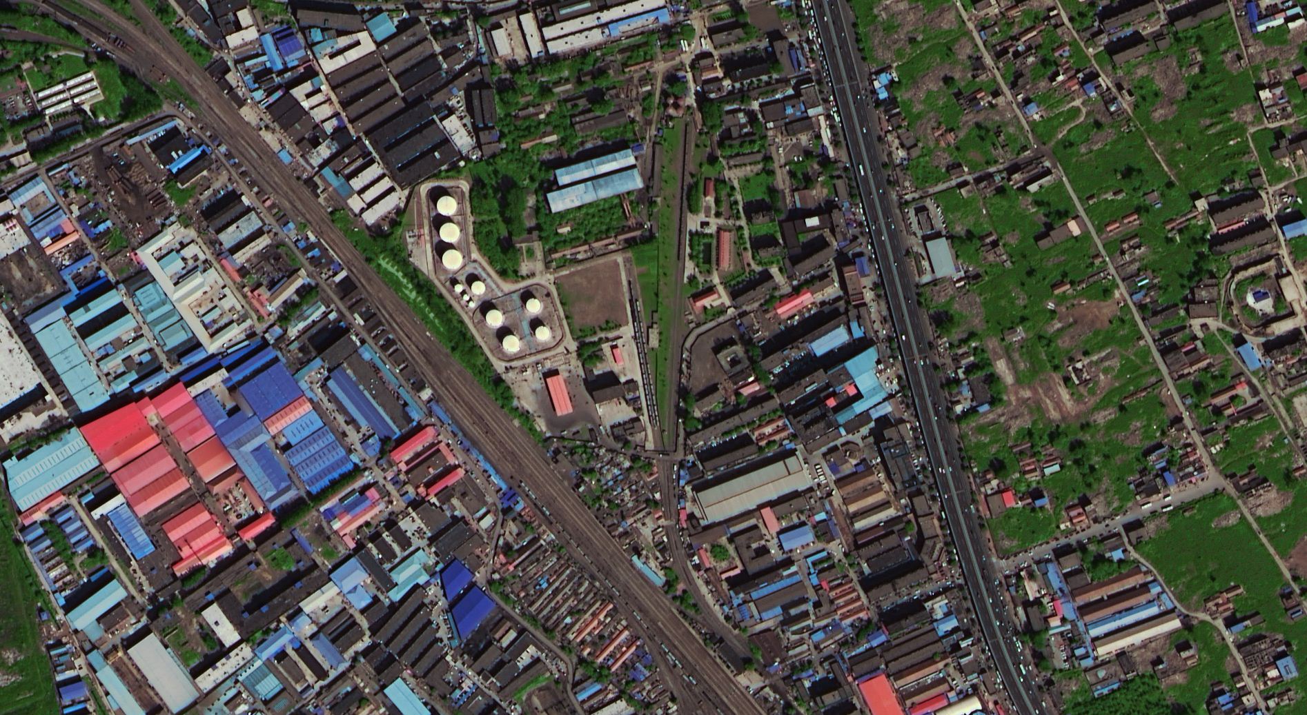
Introduction to EasyOrtho
2018-11-14
EasyOrtho is a professional remote sensing image processing software developed independently. The developer has summarized years of experience in remote sensing image processing projects and developed a set of fast remote sensing processing software suitable for engineering project applications, combining the characteristics of mainstream commercial software abroad.
EasyOrtho provides a set of highly automated, easy-to-use remote sensing software with multiple satellite sources and automated data selection, registration, correction, fusion, and other procedural functions.
EasyOrtho is particularly suitable for large-scale, urgent task production, simple and easy to learn, with high efficiency and quality assurance.
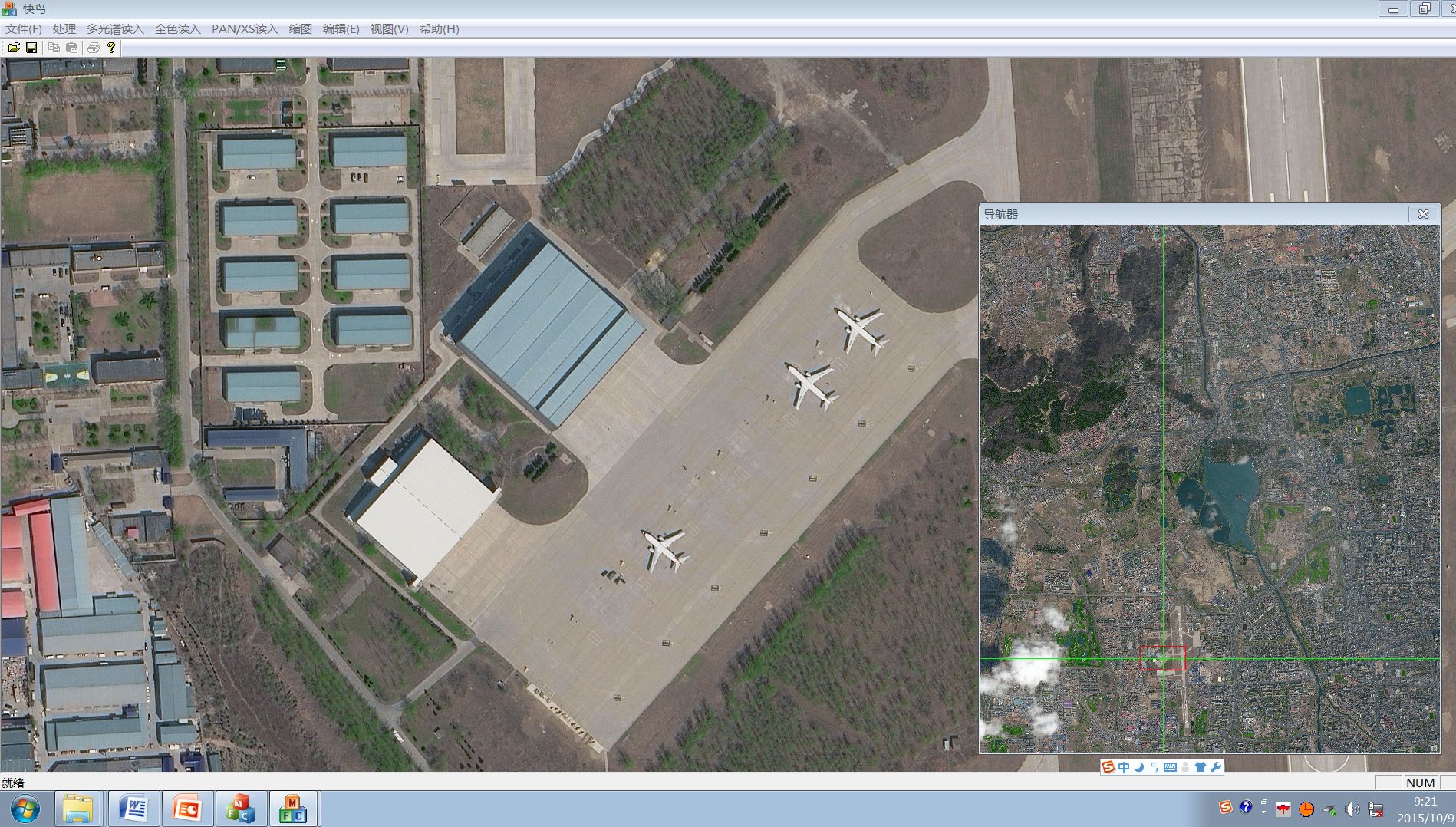
Remote sensing processing software PE
2018-11-09
After a series of tests, our company has signed a cooperation agreement for the sales and research and development of independent remote sensing processing software PE with the well-known domestic remote sensing software development company "Beijing Huatu Borui Technology Co., Ltd.". This software has undergone continuous transformation and is now able to fully automate the processing of various satellite remote sensing image data, including registration correction, fusion color adjustment, inlay color uniformity, cropping output, and other practical tools.

Upgrade and redesign of company website
2020-08-25
In order to meet the needs of development, establish a new brand image, and better meet customer visiting needs, Beijing Aerospace Jiatu Technology Co., Ltd. has upgraded and revised the original website. After months of careful planning and preparation, the new website www.yhmap.cn was officially launched on September 9, 2020, and will serve users nationwide with a brand new attitude.

The Institute of Remote Sensing and Digital Earth of the Chinese Academy of Sciences signed a cooperation agreement
2020-07-16
On July 16, 2020, our company signed a strategic cooperation agreement with the Academy of Aeronautics and Astronautics (formerly the Institute of Remote Sensing and Digital Earth of the Chinese Academy of Sciences, and the Landsat Earth Observation Center) to provide services for satellite image data acquisition and processing abroad. Fully leverage the company's advantages in data acquisition, data production, and data processing software to provide professional, high-quality, and efficient data services for Aerospace Research Institute.

Introduction to AutoMap Automatic Fusion Color Adjusting Software
2018-11-15
Satellite image fully automatic fusion software provides batch automated data fusion processing for multi-source land remote sensing satellites. This software uses the Photoshop plugin technology, based on the Photoshop platform and a self-developed remote sensing image computing knowledge base, to automatically color adjust and enhance multispectral and panchromatic images in remote sensing images, achieve geographic coordinate matching, and output commonly used remote sensing image formats.

Introduction to EasyOrtho
2018-11-14
EasyOrtho is a professional remote sensing image processing software developed independently. The developer has summarized years of experience in remote sensing image processing projects and developed a set of fast remote sensing processing software suitable for engineering project applications, combining the characteristics of mainstream commercial software abroad.
EasyOrtho provides a set of highly automated, easy-to-use remote sensing software with multiple satellite sources and automated data selection, registration, correction, fusion, and other procedural functions.
EasyOrtho is particularly suitable for large-scale, urgent task production, simple and easy to learn, with high efficiency and quality assurance.

Remote sensing processing software PE
2018-11-09
After a series of tests, our company has signed a cooperation agreement for the sales and research and development of independent remote sensing processing software PE with the well-known domestic remote sensing software development company "Beijing Huatu Borui Technology Co., Ltd.". This software has undergone continuous transformation and is now able to fully automate the processing of various satellite remote sensing image data, including registration correction, fusion color adjustment, inlay color uniformity, cropping output, and other practical tools.
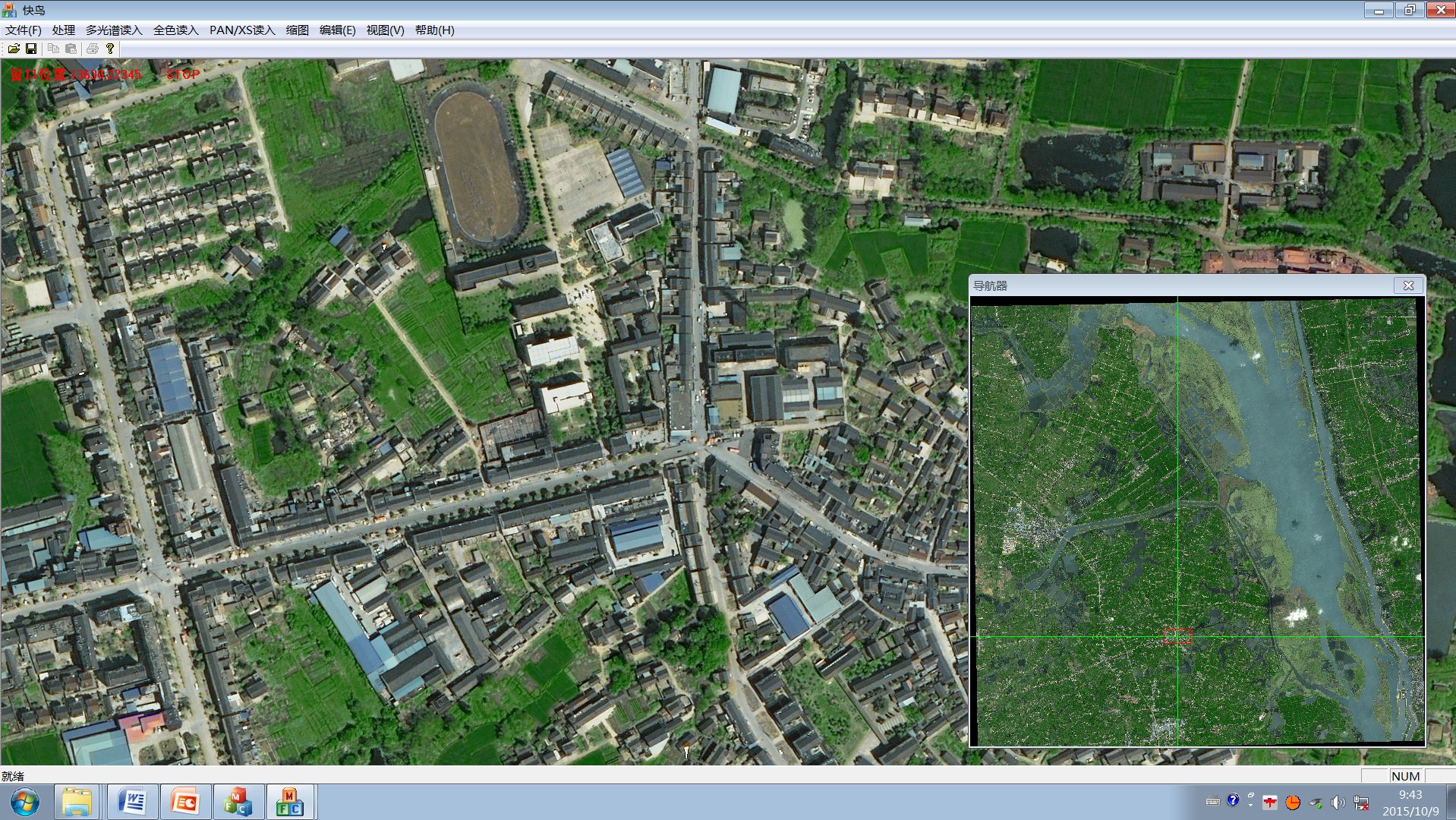
The first batch of image images transmitted from Resource 3's 02 satellite are significantly different from the results obtained from 01 satellite
2016-06-08
One day later, the newly launched Resource 3 02 satellite has started to transmit data back. At 10:57 am on May 31st, the Resource 3 02 satellite launched imaging for the first time and successfully obtained image images, including forward, forward, and backward full-color and multispectral images, covering areas such as Heilongjiang, Hebei, Inner Mongolia, Tianjin, and Shandong. The first batch of image images are clear, rich in color, and of excellent quality.

Rising space technology: Small satellites are gaining popularity
2019-01-18
Focusing on cutting-edge technological innovation and upgrading traditional industries, "Ultimately, satellite constellations may resemble more of a neural network or artificial intelligence system, enabling self-organization, deformability, self-learning, and large-scale shared perception."

The Third Land Survey Mobilization and Training Conference in Qingzhou City
2018-06-07
On June 5, 2018, Qingzhou City held the third land survey mobilization and training conference. More than 120 people attended the meeting, including Guan Mei, Deputy Director of the Cadastral and Real Estate Registration Management Office of the Department of Land and Resources, Zhu Xiaowei, Deputy Director of the Shandong Land Survey and Planning Institute, Wen Shaobo, Deputy Director of the Weifang Land and Resources Bureau, Geng Huaijin, Deputy Mayor of Qingzhou City, members of the Third Land Survey Leading Group of Qingzhou City, and the winning bidder of the Qingzhou Third Survey Project.
The History of Beijing's Changes on the Map
2017-05-04
The famous Badaling and Juyongguan were both built during the Ming Dynasty, but they are not the oldest Great Wall in Beijing. The Tonghui River, located in the southeast, surprisingly flowed from Yuquan Mountain hundreds of years ago. The "Beijing Historical Atlas", jointly compiled by Peking University and Beijing Institute of Surveying and Mapping Design and Research, and personally led by Mr. Hou Renzhi, has been released for 37 years. The complete set of books consists of 750000 words, 460 maps, and over 100 historical photos, showcasing the thousands of years of transformation of Beijing from a tribe to a metropolis.

DigitalGlobe's latest commercial remote sensing satellite put into use in the United States
2017-02-20
According to SpaceNews, the latest remote sensing satellite from DigitalGlobe, WorldView-4, has been put into commercial operation this week. WorldView-4 was launched on November 11, 2016 and has been in orbit testing and calibration for nearly three months.
DigitalGlobe announced on February 3rd that WorldView-4 has started serving its first direct access user. DigitalGlobe's users are usually government departments that have signed long-term contracts with them, and they will exchange access rights to the company's satellites when they pass through designated areas.

The high-resolution satellite WorldView-4 has been successfully launched, but DG still stands out from the crowd
2016-11-16
On November 12th Beijing time, DigitalGlobe announced that it had successfully launched the WorldView-4 satellite, which is currently the seventh and most advanced hyperspectral, high-resolution commercial satellite launched by DigitalGlobe. The satellite was launched from Vandenburg Air Force Base in California, USA, aboard the Qingtian Shen-5 carrier rocket. After 45 minutes of rocket launch, the Air Force Base received a signal from the correct orbital position of WorldView-4.

Gaofen-3 successfully launched, with three major functions playing a greater role
2016-08-15
On August 10th, at the Taiyuan Satellite Launch Center, the Long March 4 carrier rocket lifted the Gaofen-3 satellite and roared upwards, piercing the sky. At this point, the major special project family of China's high-resolution Earth observation system, following Gaofen-1, Gaofen-2, and Gaofen-4, has welcomed another "heavenly eye" detective - Gaofen-3.

Latest company news
Latest industry trends