Satellite and aerial image data processing / Success Case
Geometric correction of remote sensing images

Beijing Aerospace Jiatu Technology Co., Ltd. focuses on data and provides comprehensive spatial information system solutions for government and industry users. Our main business includes spatial data services, industry application software development services, consulting and other services.


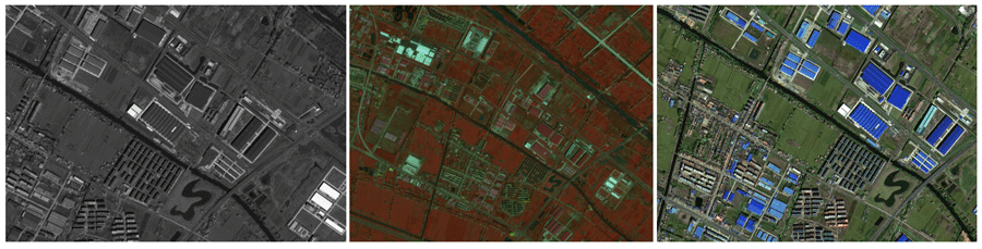
Original image (without geographic coordinates)
Fusion of panchromatic and multispectral images
Inlay uniform color

Image after geometric correction (with geographic coordinates)