


Product Services
Product List
AI algorithm
-
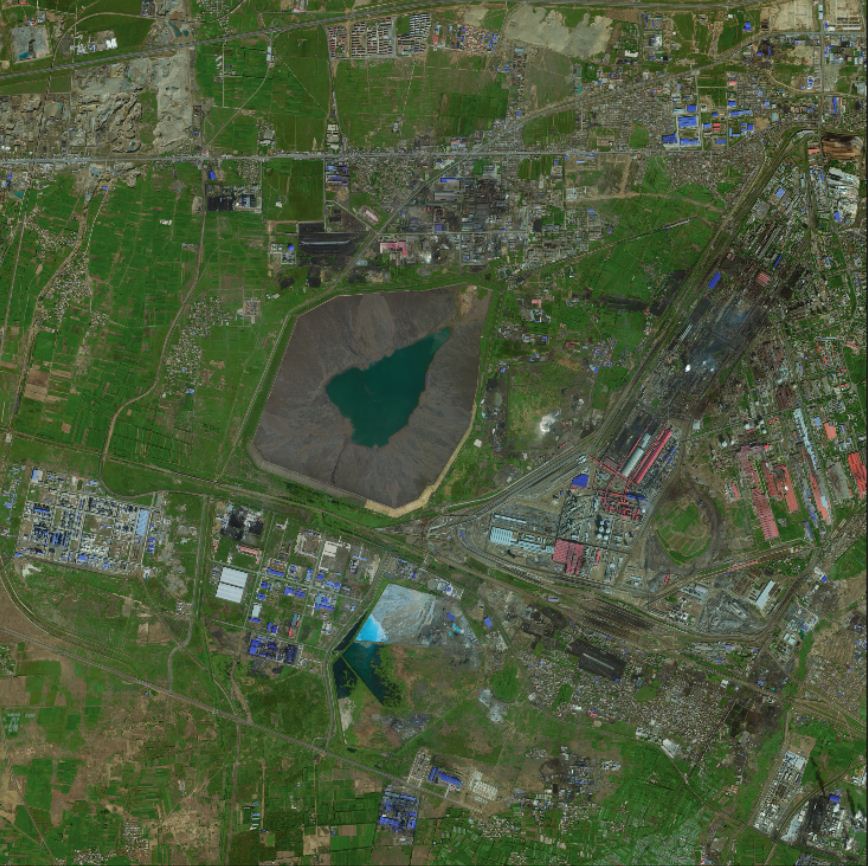
 DG Satellite Data Industry Solutions(1) Using a combination of multi-source and multi-scale remote sensing data and existing achievements to create a highly current post temporal DOM; Multi source refers to multiple remote sensing image data sources, including GeoEye-1, QuickBird, WorldView-1, WorldView-2, Pleiades-1, IKONOS, Tianpi-1, Remote Sensing 2, SPOT5, Resource 3, Resource 02C, IRS-P5, RapidEye, Remote Sensing 8, HJ-1/2 star, etc; Multi scale remote sensing data refers to remote sensing data of different resolutions, including a type of area (such as GeoEye-1, QuickBird, WorldView) using remote sensing data with a resolution better than 1 meter (panchromatic+multispectral); The second category area (such as SPOT5 and Tianpi-1) uses 2.5-meter resolution (panchromatic+multispectral) remote sensing data; Three types of areas (such as Remote Sensing No. 2) use domestically produced 2-meter resolution panchromatic remote sensing data and (such as RapidEye) multispectral data with a resolution of about 5 meters; The four types of areas use domestically produced 5-meter resolution remote sensing data. The existing achievement materials include the basic map (second survey map) issued by the project organization and implementation party, administrative boundaries, DEM elevation data, and previous phase DOM data.View more
 -
 WorldView-1 remote sensing satellite image dataThe WorldView-1 satellite is a high-resolution commercial satellite of DigitalGlobe Corporation in the United States. It was successfully launched on September 18, 2007 and can provide satellite images with a resolution of 0.5m. The flexible lens enables it to quickly locate targets and efficiently perform stereo capture.View more
 -
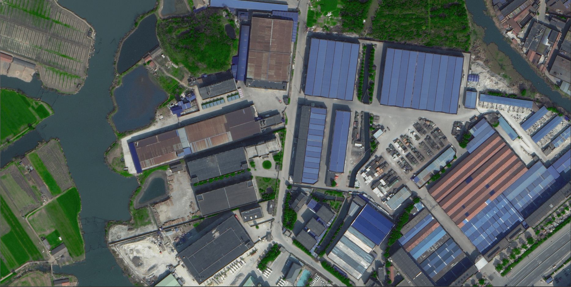
 WorldView-2 satellite remote sensing image dataThe WorldView-2 satellite was successfully launched in the autumn of 2009 and is the world\\\'s first commercial high-resolution satellite with 8 multispectral bands. It operates in a solar synchronous orbit at a height of 770km and can provide 0.5 meter panchromatic images and 1.8 meter resolution multispectral images. The WorldView-2 satellite was launched on October 6, 2009, providing 0.5 meter panchromatic images and 1.8 meter resolution multispectral images. This satellite will enable DigitalGlobe to provide high-performance imaging products that meet the needs of commercial users around the world. The onboard multispectral remote sensor will not only have four industry standard spectral bands (red, green, blue, and near-infrared), but also include four additional bands (coastal, yellow, red edge, and near-infrared 2). The diverse spectral bands will provide users with the ability to accurately detect and map changes. Due to the faster response speed of the WorldView satellite to instructions, the turnaround time of images (from issuing imaging instructions to receiving images) is only a few hours rather than a few days.View more
 -
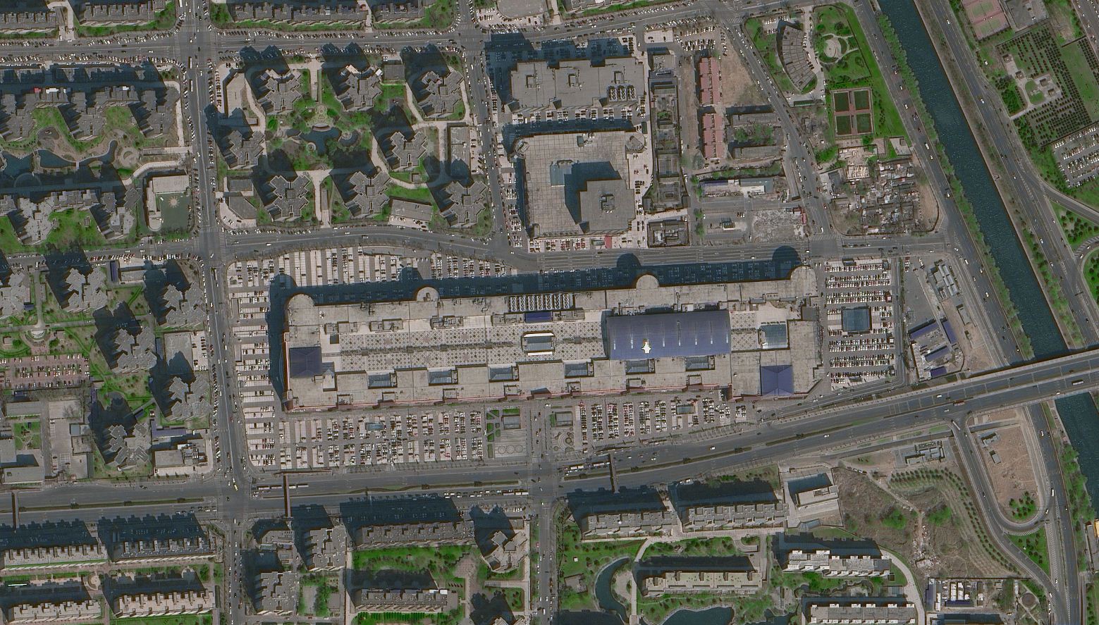
 WorldView-3 remote sensing satellite image dataWorldView-3 is the fourth generation high-resolution optical satellite owned by DigitalGlobe in the United States. It was successfully launched in August 2014 and can capture images with a maximum resolution of 31 centimeters, making it the highest resolution commercial optical satellite on the market. WorldView-3 not only has the same high optical resolution and geometric accuracy as WorldView-2, but also can obtain image data in a shorter time, with a wider shooting area. In addition to the 8-band spectral information provided by WorldView-2, an additional 20 special bands have been added, including 8 short wavelength infrared (SWIR) bands, which are more conducive to the classification and detection of special features. In addition, 12 CAVIS-ACI bands distributed from visible to invisible light are also provided, which is beneficial for cloud and fog detection, image restoration, and obtaining more accurate ground reflectance, resulting in more beautiful images.View more
 -
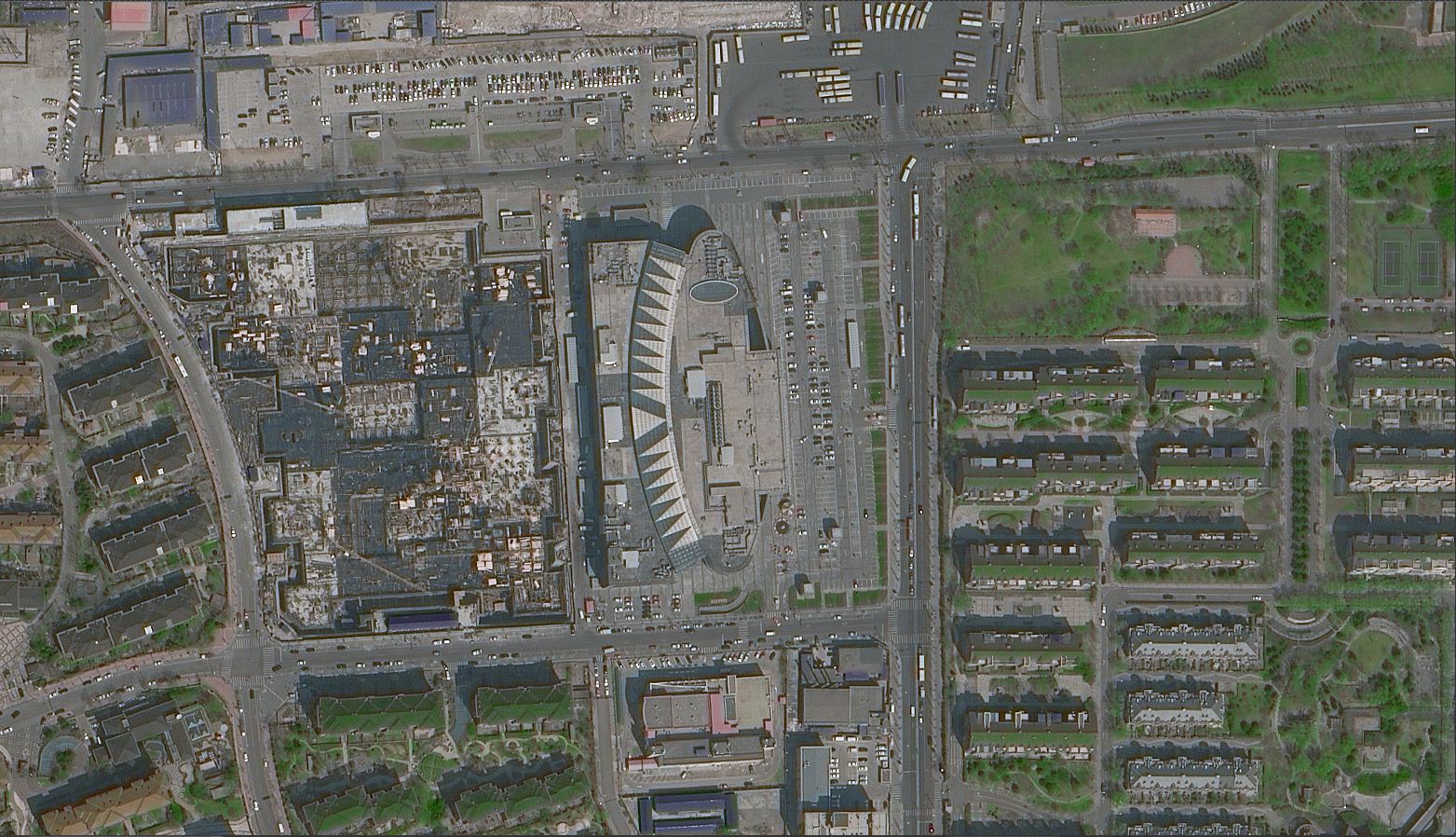
 WorldView-4 satellite remote sensing image dataThe WorldView-4 satellite is a commercial high-resolution remote sensing satellite of DigitalGlobe. It was launched in November 2016 on the US Optimus 5 carrier rocket and is currently operating at an expected orbital altitude of 617 kilometers. Like the WorldView-3 successfully launched in 2014, WorldView-4 is capable of capturing satellite images with a panchromatic resolution of 31 centimeters and a multispectral resolution of 1.24 meters. Compared to WorldView-3, WorldView-4 can move from one target to another faster and store more data.View more
 -
 Gaofen-1 remote sensing satellite image dataGaofen-1 satellite is the first satellite of China\\\'s high-resolution Earth observation system, successfully launched on April 26, 2013. The full-color resolution of Gaofen-1 is 2 meters, and the multispectral resolution is 8 meters. Its feature is the addition of a high-resolution multispectral camera, which has the strongest performance among the Earth observation satellites put into operation in China. In addition, the wide swath multispectral camera of Gaofen-1 has a width of 800 kilometers and a revisit period of only 4 days. Gaofen-1 achieves a perfect combination of high spatial resolution and high temporal resolution. It provides high-precision and wide-ranging spatial observation services for the departments of land and resources, agriculture, and environmental protection. It plays an important role in areas such as geographic surveying, ocean and climate meteorological observation, water conservancy and forestry resource monitoring, urban and transportation refined management, epidemic assessment and public health emergency response, and earth system scientific research.View more
Product Services
A one-stop service company that relies on high-resolution remote sensing imaging technology and integrates remote sensing (RS), global satellite positioning system (GPS), geographic information system (GIS), and artificial intelligence technology (AI).
Value added services
Satellite constellations